

- Stock: In Stock
- Product code: 920372000001061015
- Weight Brutto: 9.00kg

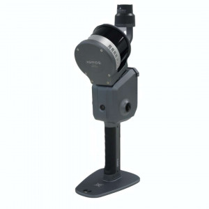
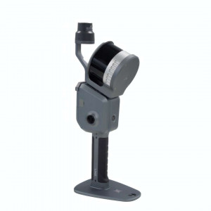
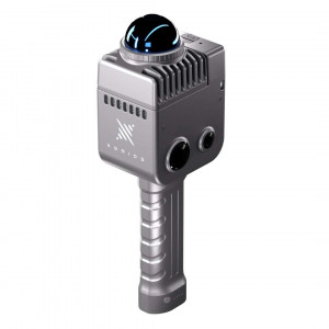
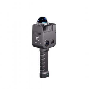
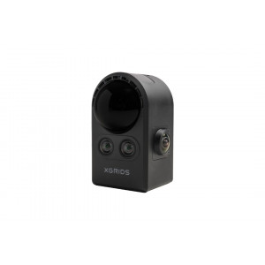
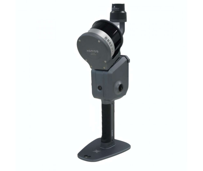
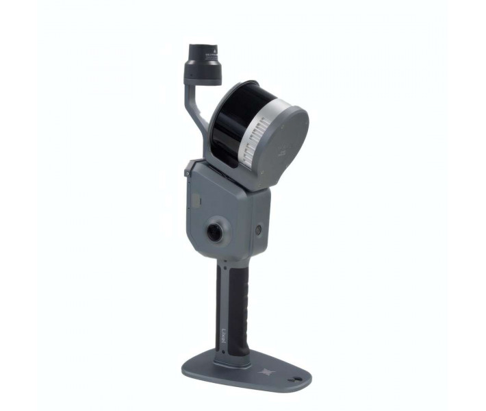
LiDAR scanner XGRIDS L2 Pro 16/120 (standard kit) — a portable SLAM system for real-time scanning. The device combines a rotating LiDAR, two 48 MP panoramic cameras and a 6-axis IMU with AI processing. The point cloud forms instantly, with no post-processing, with industrial positioning accuracy. The aluminium housing and IP54 protection ensure stable operation on site.
| Parameter | Your benefit |
|---|---|
| Absolute accuracy (RMSE): 3 cm | Georeferencing without ground control reduces the need for repeat measurements on site. |
| LixelUpSample™ point cloud density: 1,000,000 points/m² (1 mm step) | A dense point grid makes it possible to distinguish fine structural elements already at the field data collection stage. |
| Continuous operating time: 90 min. | A single charge is enough for one pass of a medium-sized site without stopping to recharge. |
| Device weight: 1.7 kg (without battery) | The lightweight housing reduces operator fatigue during prolonged handheld scanning. |
The key advantages of the XGRIDS L2 Pro 16/120 Standard Package stem from the combination of hardware and a proprietary processing algorithm.
-
Real-time processing: the LiDAR, panoramic cameras and IMU work together, so the coloured point cloud is ready immediately after scanning, with no separate post-processing stage.
-
LixelUpSample™ algorithm: densifying the point cloud to a 1 mm point-to-point spacing gives sharper contours of lines and edges in subsequent drafting.
-
Multi-SLAM: the system maintains absolute coordinates even in tunnels, underground spaces and other areas with limited satellite signal.
-
IP54 protection and -20 °C – 50 °C range: the device remains operational on open sites and in industrial premises without an additional housing.
Operating principle: SLAM with real-time processing
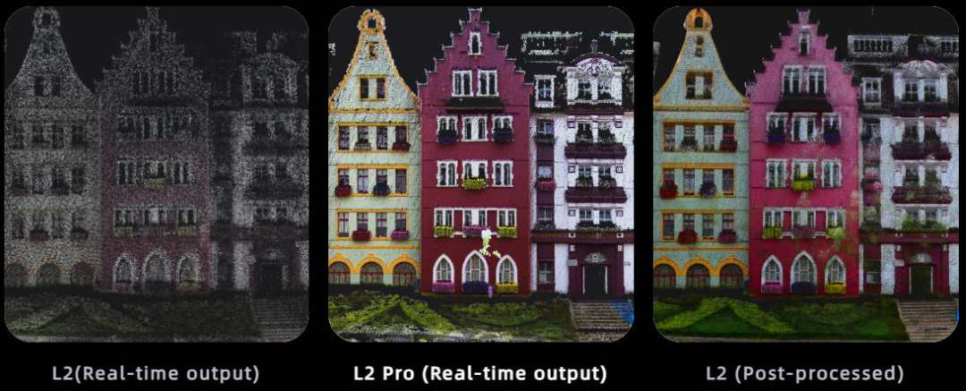
The XGRIDS L2 Pro 16/120 Standard Package generates a coloured point cloud directly during scanning, rather than after uploading data to a computer. A rotating LiDAR module, two 48 MP panoramic cameras and a 6-axis IMU (inertial measurement unit) feed data into a shared multi-SLAM algorithm. The result — accuracy that previously required a separate post-processing stage — is now available on-screen instantly.
The figure below illustrates the difference between the operating modes of the previous model and the L2 Pro's result.
Hardware platform
The housing is made of industrial-grade aluminium alloy, and the weight without battery is 1.7 kg. The rotating LiDAR (16 channels, 0.5–120 m range) works together with two 48 MP cameras for panorama capture and a separate camera for visual positioning with a global shutter. This sensor set eliminates the need for external cameras during field surveying.
LixelUpSample™ algorithm
The algorithm densifies the source cloud to 1,000,000 points/m² at a 1 mm step, keeping the cloud thickness within 5 mm over a distance of up to 10 m from the trajectory. A denser point grid delivers a photorealistic coloured image of surfaces without an additional post-processing stage.
The sample below shows the level of detail the algorithm delivers on a complex decorative surface.

Multi-SLAM for challenging conditions
The exclusive multi-SLAM algorithm improves mapping stability where satellite signal is weak or absent: indoors, in basements, underground and in tunnels. This allows data collection to continue without a break in coordinate referencing even with a temporary loss of RTK signal.
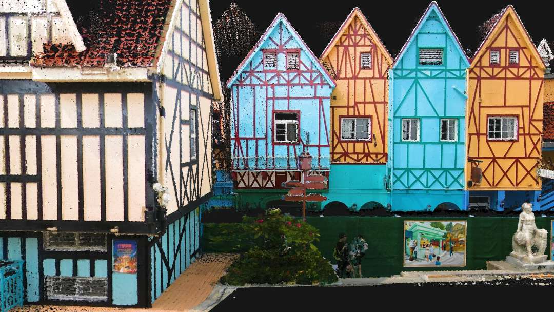
The reconstruction below demonstrates the level of detail of the coloured point cloud on an architectural façade.
Real-time data with absolute coordinates
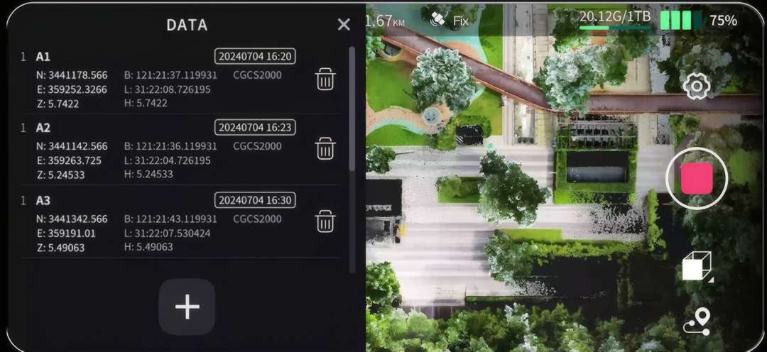
With RTK (Real-Time Kinematic satellite positioning) support, the device maintains absolute coordinate referencing even during a brief signal loss of up to 100 m. Geodetic point coordinates are available immediately on the app screen alongside the live scanning video.
The screen shown below shows how the operator sees the saved geodetic points alongside the live scanning video.
Software and automation
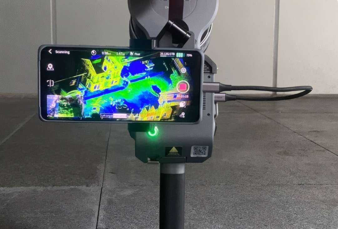
The LixelStudio desktop application covers the full point cloud workflow: capture, editing and processing, and it also supports the .las and .ply formats and plugins for third-party software. The LixelGO mobile application controls scanning directly from a smartphone, shows data collection progress and allows the operator to check point cloud quality right in the field.
A direct phone-to-scanner connection removes the intermediate step of transferring data to a computer during quality checks.
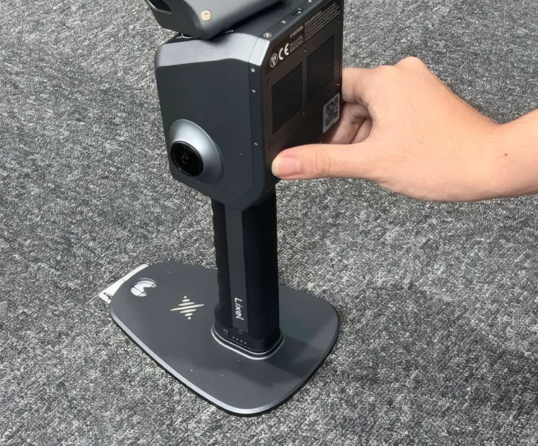
Scan control is reduced to a single button on the device housing.
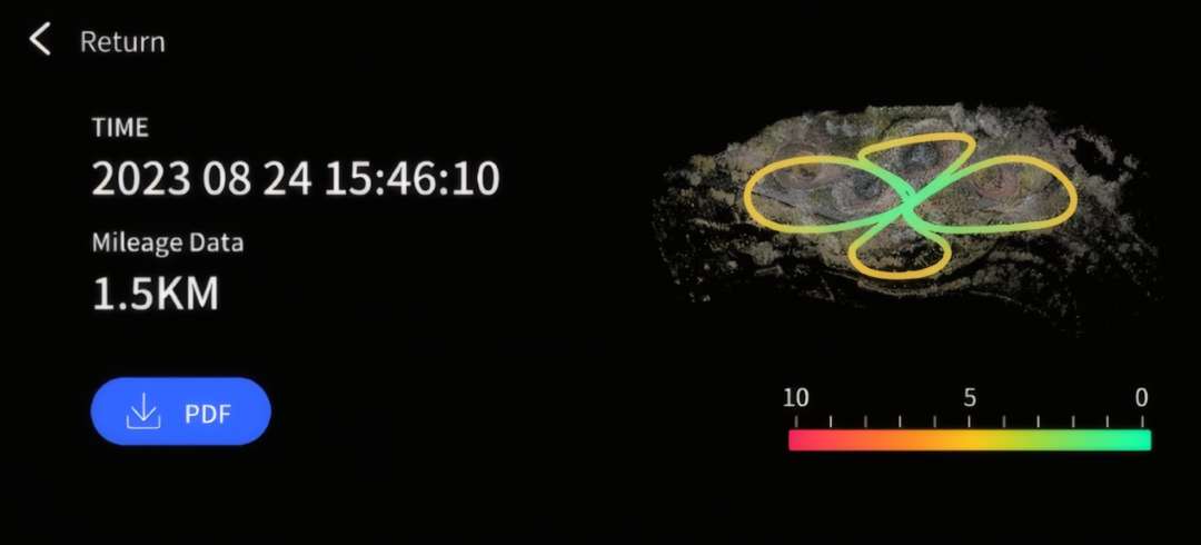
Once a session is complete, the accuracy verification report shows the operator the route and the quality of the collected data without transferring files to another device.
Operating conditions and housing protection
The IP54 protection rating and the -20 °C – 50 °C operating range allow the scanner to be used on construction sites, quarries and in the field without an additional housing. The industrial aluminium housing withstands daily transport in a backpack between survey sites.
Applications
-
Topographic surveying: a point cloud with an absolute accuracy of 3 cm allows digital terrain models to be created without ground control at each site.
-
Engineering surveys: the real-time coloured point cloud shortens the time between field data collection and delivering results into project documentation.
-
Inspection and maintenance: a repeatability accuracy of 2 cm allows comparison of an object's condition between periodic surveys.
-
Construction: control of completed works on site is carried out without stopping the process for a separate post-processing stage.
-
Agriculture and forestry: multi-SLAM maintains the coordinate reference under tree canopy, where satellite signal is weakened.
-
Film and game production: the LixelUpSample™ algorithm generates a photorealistic coloured point cloud for subsequent use as a set reference.
Compatibility of the XGRIDS L2 Pro 16/120 Standard Package
-
2 m extension pole: an optional accessory for surveying hard-to-reach or elevated areas without changing the operator's position.
-
Smartphone mount: allows a phone to be mounted on the housing for direct connection during scanning.
-
Drone mount: adapts the scanner for aerial surveying without manual carrying.
-
Vehicle mount: used for mobile scanning along a route.
-
Backpack with stabilising shoulder strap / soft-shell backpack: options for carrying the device between survey sites.
Package contents
XGRIDS L2 Pro 16/120 device
Battery (14.4 V, 46.8 Wh)
Standard RTK Module
Ground Control Point (GCP) Plate
USB 3.1 cable
Carrying case
User manual
Technical specifications of the XGRIDS L2 Pro 16/120 Standard Package
| General information | |
|---|---|
| Operating temperature | -20 °C – 50 °C (-4 °F – 122 °F) |
| Protection rating | IP54 |
| Voltage | 14.4 V |
| Capacity | 46.8 Wh |
| Point cloud formats | .las, .ply |
| Image formats | .jpg |
| System parameters | |
| Weight | 1.7 kg (without battery) |
| Dimensions | 180 × 130 × 400 mm |
| Housing | industrial aluminium alloy |
| Power consumption | <30 W |
| Interfaces | USB 3.1 Gen2 |
| Storage | 1 TB SSD |
| Continuous operating time | 90 min. |
| Wireless connectivity |
|
| Accuracy | |
| Absolute vertical/horizontal accuracy (RMSE) | 3 cm |
| Real-time relative accuracy (RMSE) | 2 cm |
| Post-processed relative accuracy (RMSE) | 1 cm |
| Repeatability accuracy (RMSE) | 2 cm |
| Point cloud thickness | 0.5 cm |
| LixelUpSample™ | supported |
| Functions | |
| Visual positioning | supported |
| Real-time colourisation | supported |
| Real-time RTK data fusion | supported |
| LiDAR module (XGRIDS L2 Pro 16/120) | |
| Number of channels | 16 |
| Scanning range | 0.5–120 m |
| Laser class / wavelength | Class 1 / 905 nm |
| Sensor field of view | 360° × 270° |
| Scanning rate | 320,000 points/s |
| Panoramic camera | |
| Camera resolution | 2 × 48 MP |
| Panorama resolution | up to 56 MP |
| Focal length | 2 mm |
| Aperture | F/2.0 |
| CMOS sensor | 1/2" |
| Shutter | rolling shutter |
| Field of view | 190° × 190° |
| Visual positioning camera | |
| Resolution | 1 × 1 MP |
| Shutter | global |
| Field of view | 190° × 119° |
Questions and answers
What is included in the L2 Pro standard kit?
The XGRIDS L2 Pro 16/120 standard package includes the scanner itself, a battery, a charging cable, a USB 3.1 cable, a soft carrying bag, a carrying case, and also a Control Point Plate and a Standard RTK Module — both of these items are already included in the package.
-
The device is ready to use straight out of the box, with no need for additional purchases of modules
-
The included RTK module allows absolute coordinates to be obtained without a separate purchase
The case and backpacks ensure safe transport to the site
How is this scanner better than devices requiring post-processing?
The L2 Pro delivers a finished coloured point cloud in real time, with quality matching post-processed results — a unique advantage of the "zero post-processing era". Thanks to the fusion of LiDAR, visual sensors and an IMU with AI, the operator gets the final result right in the field, without waiting for processing on a computer.
-
The exclusive LixelUpSample™ algorithm increases point cloud density to 1 million points/m² with a 1 mm step
-
A point cloud thickness of just 5 mm ensures precise rendering of lines and boundaries of objects
-
Instant data quality verification directly on site saves the time of repeat site visits
Which industries is this scanner suitable for?
The L2 Pro is optimally suited for topographic surveying, engineering work, construction, inspection and maintenance of facilities, as well as forestry and agriculture and film/game production. A LiDAR scanning range of up to 120 m and dual 48-megapixel panoramic cameras make the device versatile both for large open areas and for detailed surveying of complex objects.
-
Multi-mode SLAM ensures stable mapping even in challenging conditions — tunnels, underground transit, underground spaces
-
An IP54 protection rating and an operating temperature range of -20 °C to 50 °C allow operation outdoors in various climatic conditions
-
Drone, vehicle, body-worn or extension pole mounts expand the usage scenarios
How easy is the scanner to use in day-to-day work?
The L2 Pro is designed for single-button control — starting, stopping scanning and marking control points are all done with simple button presses, requiring no special operator training. Additionally, via the LixelGO app, you can control scanning from a smartphone and instantly check the quality of collected data.
-
A colour indicator clearly shows the device's current status (standby, scanning, USB mode), minimising operator errors
-
A battery life of 90 minutes and charging in ~2 hours allow the device to be quickly put back into service
-
The LixelStudio PC software provides a full workflow — from capture to point cloud processing in .las and .ply formats
What is the real-time measurement accuracy?
The device delivers an absolute accuracy of 3 cm (RMSE) and a real-time relative accuracy of 2 cm — these figures match the quality of post-processing in other systems. Post-processing the data can further improve relative accuracy to 1 cm.
-
The 16-channel LiDAR operates at a range of 0.5–120 m with a scanning rate of 320,000 points/s
-
A repeatability accuracy of 2 cm guarantees consistent results across multiple measurements
-
Multi-sensor fusion of LiDAR, visual cameras and an IMU with AI maintains accuracy even in areas with limited satellite signal
Why buy the XGRIDS L2 Pro 16/120 Standard Package from EXPERT3D?
EXPERT3D has been supplying professional 3D equipment since 2012. Our engineers provide expert consultation before purchase and help select the configuration for a specific survey task. The device comes with an official warranty and authorised service support. Delivery of the XGRIDS L2 Pro 16/120 Standard Package is available to Spain and other EU countries. As the official representative of XGRIDS, we guarantee 100 % authenticity, a fair price, authorised service and an official warranty on every product.