

- Stock: In Stock
- Product code: 920372000001061043
- Weight Brutto: 9.00kg

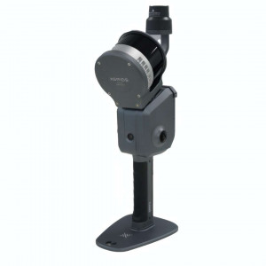
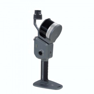
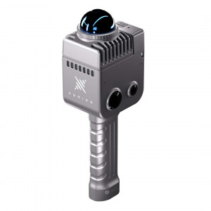
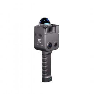
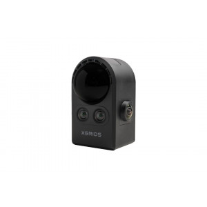
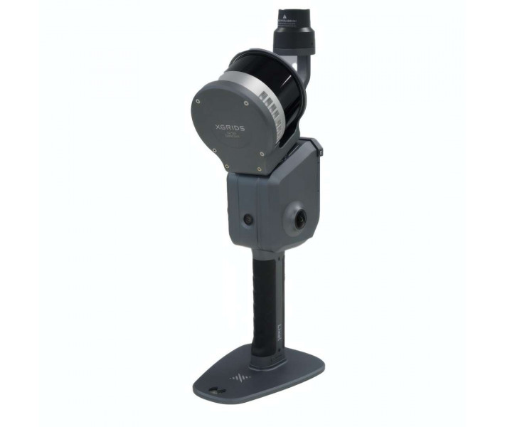
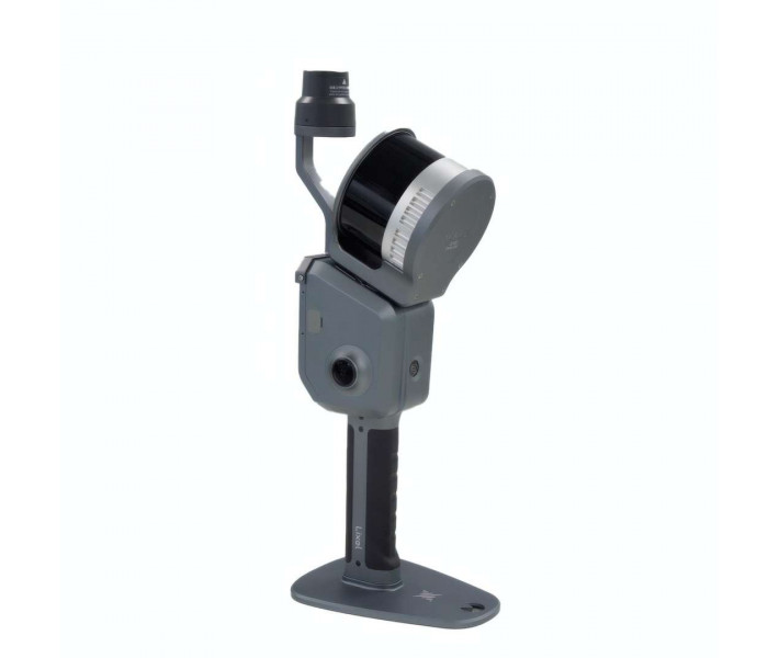
The XGRIDS L2 Pro 32/300 Standard Package is a portable 3D scanning system for creating high-precision maps without post-processing delays. The device integrates a 32-channel LiDAR, panoramic cameras, and an IMU module. The LixelUpSample™ algorithm provides a model density of up to 1000000 points/m² with a 1 mm interval.
| Parameter | Your advantage |
|---|---|
| Absolute accuracy: 3 cm | Eliminates the need for time-consuming coordinate adjustment during surveying on large infrastructure sites. |
| Point cloud thickness: 0.5 cm | Ensures clear extraction of contours and lines when modelling engineering networks and architectural elements. |
| Battery life: 90 min | Allows large-scale scanning sessions to be performed without interruptions for battery replacement in the field. |
| LiDAR range: 300 m | Guarantees effective capture of spatial data on open construction sites and in quarries. |
Built-in computing power generates a colour point cloud while the operator is moving. This allows for an instant check of the survey's completeness and the presence of "blind spots" before even leaving the site.
Positioning and data collection technology
The system uses an integrated Multi-SLAM algorithm to jointly optimise data from various sensors. The rooftop LiDAR works in synergy with a high-precision 6DOF IMU and visual sensors. This ensures continuous generation of absolute coordinates even in areas with limited satellite signal.
The integrated SLAM algorithms process data simultaneously with its acquisition, eliminating the need to wait for results. This brings the field stage directly closer to the final use of the model.
Colour processing and LixelUpSample™
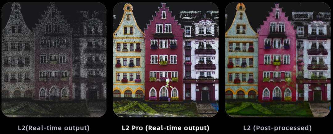
The system is equipped with two panoramic cameras with a resolution of 48 MP each. They provide a 190° × 190° field of view, which eliminates the need to use external cameras. The device automatically overlays RGB data onto the laser reflection points.
Proprietary hardware density upscaling technology transforms a standard dataset into a photorealistic model with ultra-high colour accuracy.

Design and hardware
The weight of the scanner is 1.7 kg without the battery, making it suitable for prolonged handheld surveying. The power consumption of the system does not exceed 30 W. The design provides for installing the battery in the lower compartment with secure locking by a locking lever.
The industrial aluminium casing has an IP54 protection level, and the metal base guarantees stable initialisation of the device on a surface before starting work.
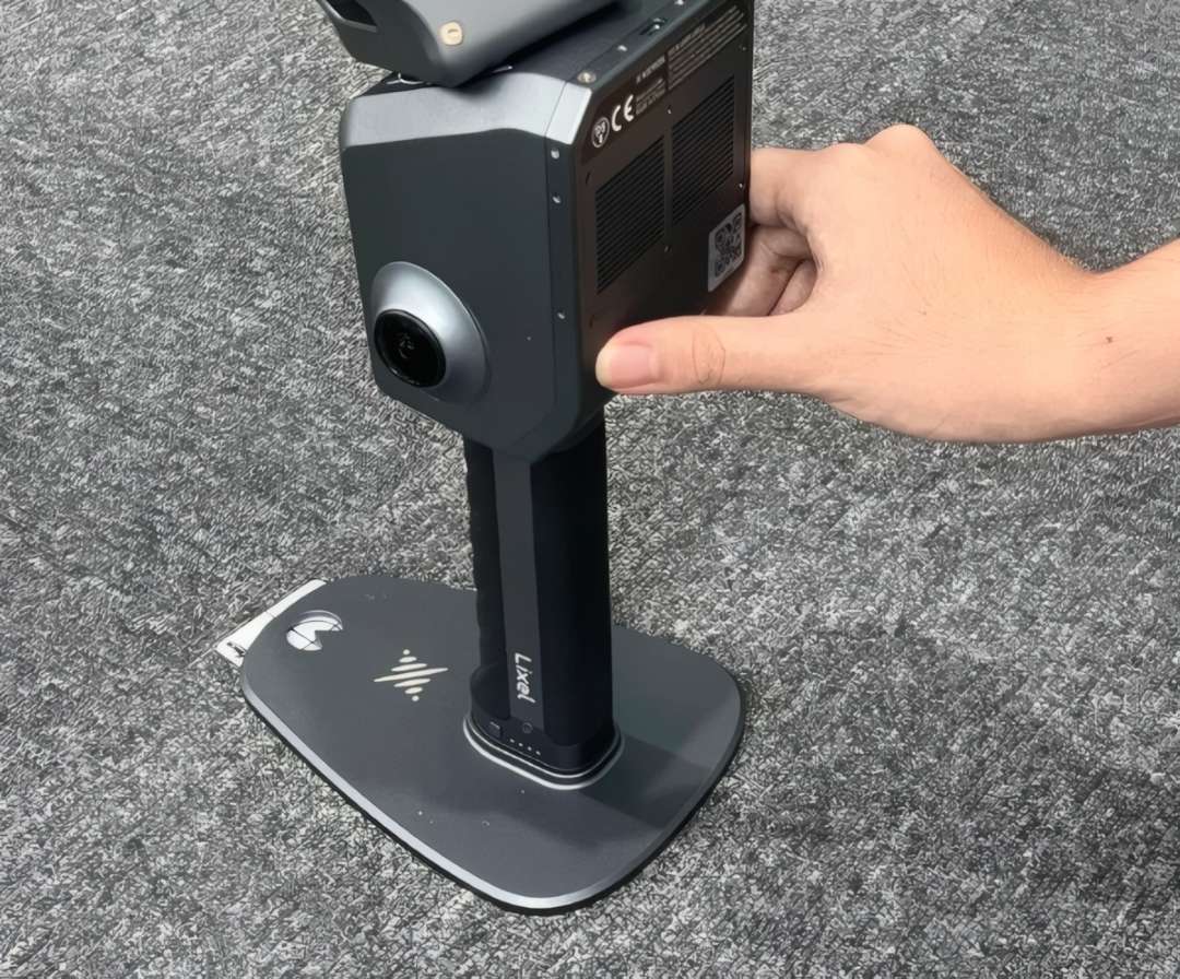
The rotating Class 1 LiDAR module operates at a wavelength of 905 nm. It covers a field of view of 360° × 270° and can generate 640000 points/s. To ensure optimal thermal regulation, it is important not to block the ventilation openings during prolonged use.
Software and workflow
The workflow is supported by two main software environments: the LixelGO mobile app and the LixelStudio desktop editor. The user can connect the scanner to a PC via the USB 3.1 Gen2 interface to transfer collected datasets.
The surveying process is controlled directly through the LixelGO mobile app, which connects to the system to monitor the device status.
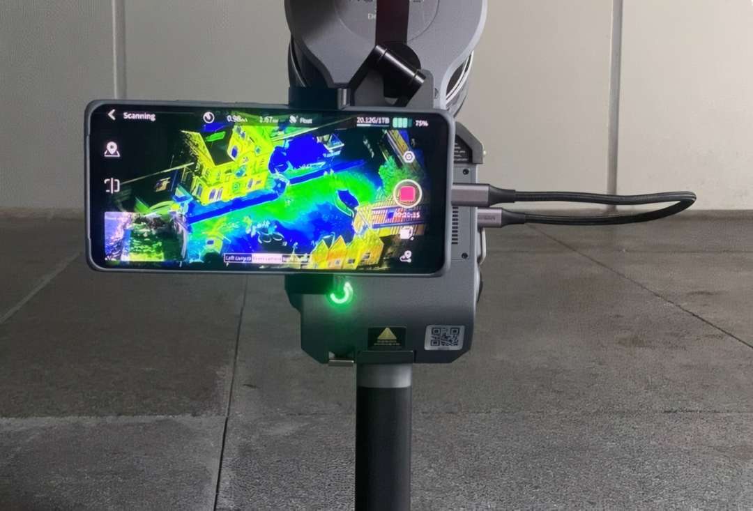
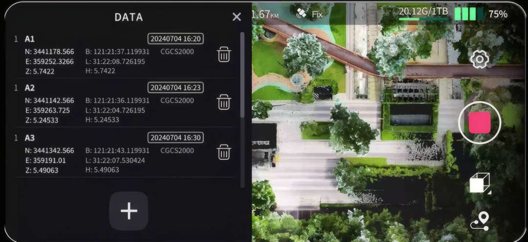
The functionality includes a one-click ground control point (GCP) marking process directly during scanning. This ensures accurate referencing of collected data to a local or global coordinate system.
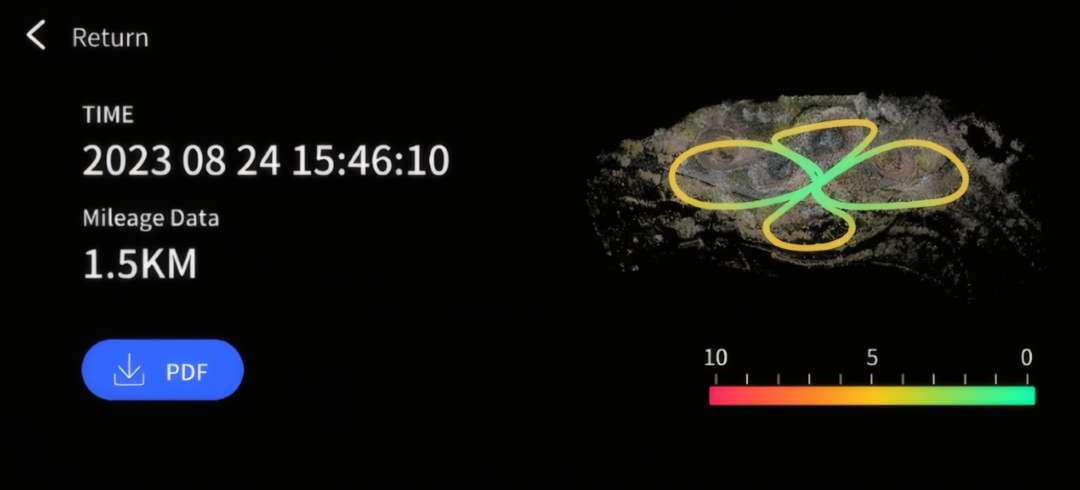
After the session is complete, the user receives a detailed accuracy report documenting the movement trajectory, distance, and an assessment of possible deviations.
Data is saved in industry-standard .las or .ply formats, ensuring compatibility with most engineering CAD/BIM platforms.
During recording, the system displays the current coordinates and the remaining space on the built-in 1 TB solid-state drive on the smartphone screen.
Ergonomics and additional equipment
To ensure maximum operator mobility on complex sites, the device supports the use of additional load-bearing systems and stabilisation mounts.
To integrate the device with various carriers, use a drone mount, a car mount, or an extension pole.
The video below demonstrates the scanner operating paired with an ergonomic load-bearing vest.
Areas of application
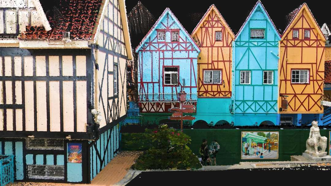
The system is adapted for architectural documentation, renovation planning, and heritage preservation with millimetre detail of facades.
-
Topographic surveying: captures terrain with 3 cm absolute accuracy thanks to a laser range of up to 300 m and RTK integration.
-
Engineering and construction: enables quick comparison of the actual state of the object with the design BIM model due to a point cloud thickness of 0.5 cm.
-
Infrastructure inspection: works in challenging conditions, such as underground utilities or tunnels, maintaining positioning stability through Multi-SLAM optimisation.
-
Forestry: multi-pulse 32-channel LiDAR effectively penetrates dense vegetation to accurately build a digital terrain model (DTM).
-
Film and game production: captures photorealistic textures of locations using two 48 MP cameras for direct import into graphics engines.
XGRIDS L2 Pro compatibility
-
Mounting systems: backpack with stabilisation lever, soft padded backpack, extension pole (2 m).
-
Hardware modules: Survey Grade RTK module, Standard RTK module.
-
Platform accessories: mobile phone mount, drone mount, car mount, ground control point (GCP) plate.
Package contents
XGRIDS L2 Pro 3D scanner main module
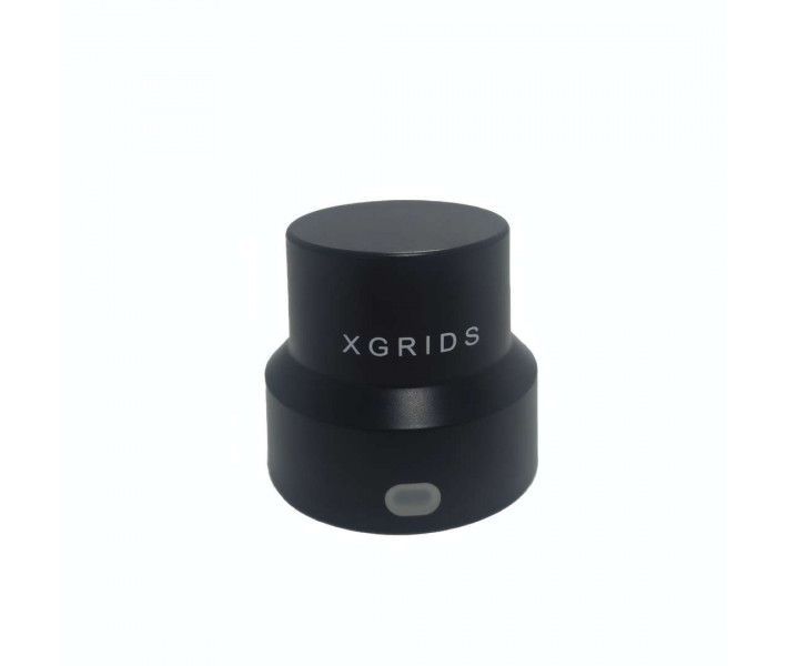
Survey Grade RTK module
Standard RTK module
Battery
Mobile phone mount
Base plate for GCP collection
USB 3.1 data cable and user manual
XGRIDS L2 Pro 32/300 Standard Package specifications
| General information | |
|---|---|
| Operating temperature | -20 °C – 50 °C (-4 °F – 122 °F) |
| IP protection class | IP54 |
| Voltage | 14.4 V |
| Capacity | 46.8 Wh |
| Point cloud formats | .las (and .ply as per the "Software" section) |
| Image formats | .jpg |
| System parameters | |
| Weight | 1.7 kg (without battery) |
| Size | 180 × 130 × 400 mm (handheld battery with GCP collection plate) |
| External casing | Industrial aluminium |
| Power consumption | < 30 W |
| Interfaces | USB 3.1 Gen2 |
| Storage | 1 TB SSD |
| Continuous operation time | 90 min |
| Wireless connectivity | Wi-Fi, Bluetooth support: 802.11a/b/g/n/ac, Wi-Fi 2.4G 2412–2472 MHz, Wi-Fi 5G2 5180–5240 MHz, Wi-Fi 5G8 5745–5825 MHz |
| Accuracy | |
| Absolute vertical/horizontal accuracy (RMSE) | 3 cm (RTK signal maintained within a 100 m radius) |
| Real-time relative accuracy (RMSE) | 2 cm (distance between points less than 100 m) |
| Post-processed relative accuracy (RMSE) | 1 cm (distance between points less than 100 m) |
| Repeatability accuracy (RMSE) | 2 cm (full RTK signal for both scans) |
| Point cloud thickness | 0.5 cm (horizontal thickness within 10 m of the movement trajectory) |
| LixelUpSample™ | Supported |
| Features | |
| Visual positioning | Supported |
| Real-time RGB | Supported |
| Real-time RTK fusion | Supported |
| LiDAR (XGRIDS L2 Pro 32/300) | |
| LiDAR channels | 32 |
| Operating range | 0.5 – 300 m |
| LiDAR sensor | Class 1 / 905 nm |
| Sensor field of view (FOV) | 360° × 270° |
| Scanning rate | 640000 points/s |
| Panoramic image camera | |
| Camera resolution | 2 × 48 MP |
| Panoramic image resolution | Max. 56 MP |
| Focal length | 2 mm |
| Aperture | F/2.0 |
| CMOS | 1/2" |
| Shutter | Rolling shutter |
| Field of view (FOV) | 190° × 190° |
| Visual positioning camera | |
| Resolution | 1 × 1 MP |
| Shutter | Global shutter |
| Field of view (FOV) | 190° × 119° |
| Accessories | |
| Backpack with stabilisation lever | Dimensions: 60 × 60 × 15 cm, weight: 2.5 kg |
| Soft padded backpack | Dimensions: 55 × 35 × 25 cm, weight: 2.7 kg |
| Transport case | Dimensions: 42 × 34 × 18 cm, weight with system: 6.6 kg |
| 2 m extension pole | Supported |
| Mobile phone mount | Supported |
| Control point plate | Supported |
Why buy the XGRIDS L2 Pro 32/300 Standard Package at EXPERT3D?
EXPERT3D has been supplying professional 3D equipment since 2012. As an official representative of the XGRIDS brand, we guarantee 100% equipment authenticity, a fair price, and authorised servicing. Our specialists provide expert consultations before purchase to select the correct configuration for your engineering tasks. We provide an official warranty and prompt supply of consumables and original spare parts to minimise downtime. You receive technical support and operator training with delivery throughout Spain and the EU.