

- Stock: In Stock
- Product code: 920372000001061029
- Weight Brutto: 9.00kg

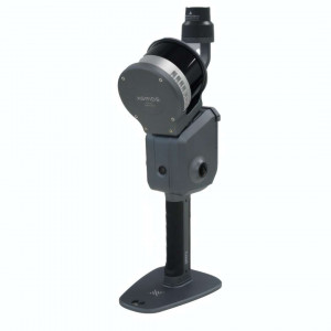
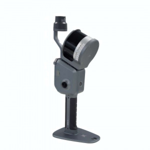
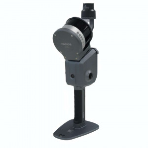
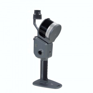
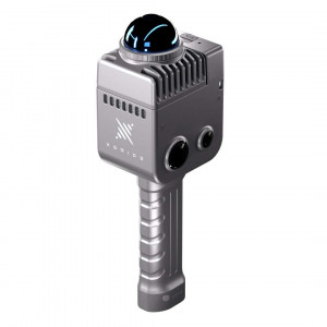
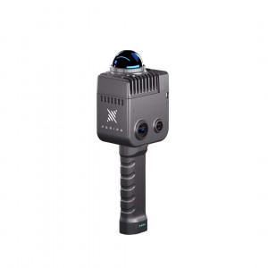
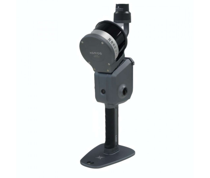
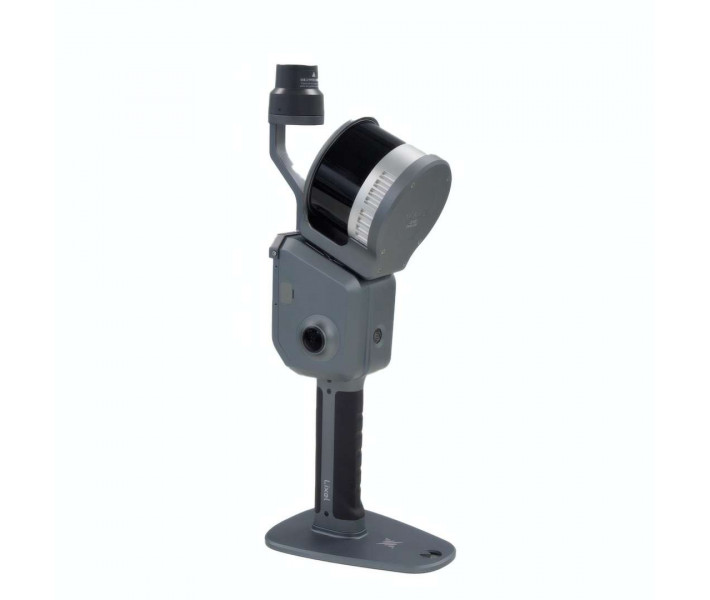
The Standard Package XGRIDS L2 Pro 32/120 — a LiDAR scanner for instant formation of coloured point clouds without a separate post-processing stage. The device combines a rotating LiDAR, dual panoramic optics and a high-precision IMU under the control of multi-sensor SLAM algorithms. The solution is suitable for topographic surveying, inspection of engineering facilities and documentation of construction directly on site. The finished coloured point cloud appears on the smartphone screen immediately after completing the route.
| Parameter | Your benefit |
|---|---|
| Absolute accuracy (RMSE): 3 cm | Allows exporting object coordinates immediately after fieldwork, without a separate post-processing stage in the office. |
| Point cloud density (LixelUpSample™): 1 million points/m² (1 mm step) | Thin structural elements — cables, rebar, seams — remain distinguishable even after scaling the model. |
| Continuous operating time: 90 min. | One battery is enough for a typical survey route of a medium-sized object without stopping to replace the battery. |
| LiDAR working range: 0.5–120 m | The scanner captures close interior details and distant structures on open terrain in a single pass. |
Multi-sensor SLAM (LiDAR, visual sensors and IMU under AI control) forms a coloured point cloud without a post-processing stage — the operator receives the finished result while still walking the site.
The exclusive LixelUpSample™ algorithm increases cloud density to 1 million points/m² — small facade details or cracks remain distinguishable already at the fieldwork stage.
The IP54 protection class and industrial-grade aluminium housing allow the scanner to be used on a construction site in light rain or dust without an additional case.
A 90-minute battery life on a single battery covers a typical survey route of a medium-sized object without replacing the battery during operation.
Technology: multi-sensor SLAM with AI
The Standard Package XGRIDS L2 Pro 32/120 integrates a rotating LiDAR, a dual panoramic optical system at 48 MP each, and a 6-axis IMU (inertial measurement unit) in a single housing without external cameras. Multi-sensor SLAM algorithms (simultaneous localisation and mapping) process data from all sources simultaneously, which increases trajectory stability even with fast movement by the operator.
Instant results without post-processing
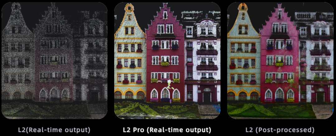
The L2 Pro forms a point cloud in real time, the quality of which corresponds to the result of classic post-processing of the previous L2 model. The operator sees the finished coloured result right in the field, without a separate processing stage in office software.
Direct connection of a smartphone to the scanner allows monitoring the scanning process without additional equipment — the progress of cloud formation is visible on the screen immediately.

A comparison of results illustrates the difference between the previous L2 model and the L2 Pro: the sparse black-and-white scan of the L2 in real-time mode differs from the denser coloured cloud of the L2 Pro obtained without post-processing, and practically coincides with the L2's post-processing result.
LixelUpSample™ algorithm and cloud density
The exclusive LixelUpSample™ algorithm increases point cloud density to 1 million points/m² with a 1 mm step between neighbouring points. The cloud thickness does not exceed 5 mm within 10 m of the operator's movement trajectory, which reduces contour blurring during the construction of lines and cross-sections.

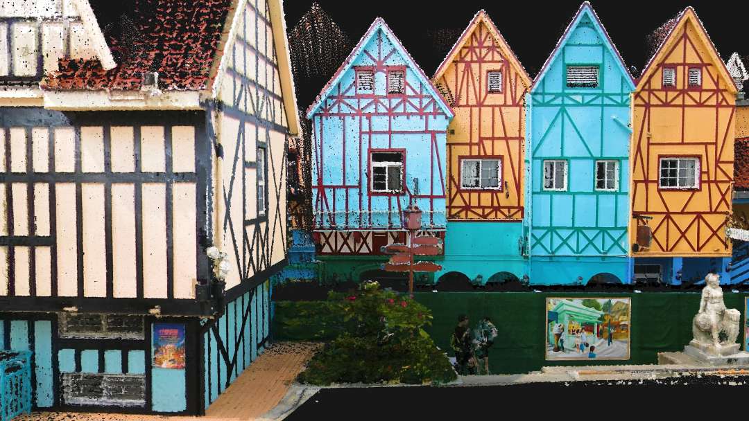
Ultra-high colour accuracy ensures a photorealistic appearance of the cloud even on facades with complex texture and fine ornamentation.
Stability in challenging conditions
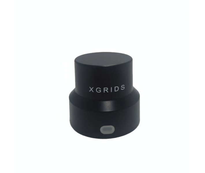
The exclusive Multi-SLAM algorithm increases the device's adaptability in environments with limited satellite signal reception — indoors, underground, in subways and tunnels. The system maintains continuous absolute coordinates even when the RTK signal is lost within a radius of up to 100 m from the base station.
Real-time data with absolute coordinates
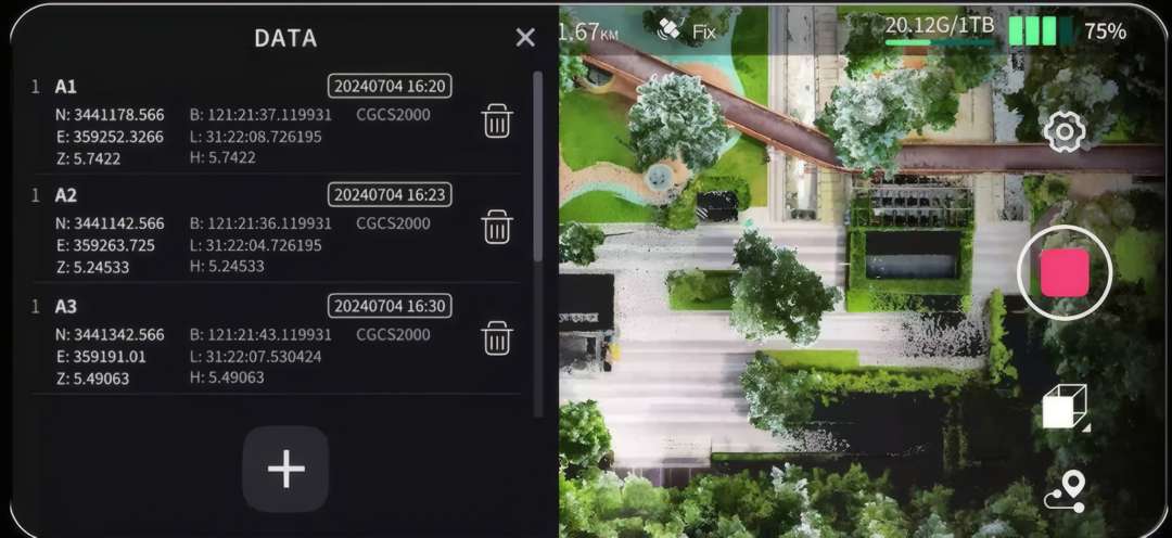
The coordinates of each saved point are available immediately during scanning, without waiting for upload to third-party software. The application's split screen allows monitoring both the point list and the live mapping camera feed simultaneously.
Workflow: verification, connection and GCP marking
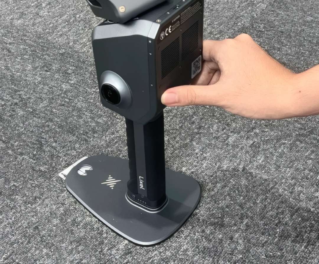
The package supports an accuracy verification report, direct smartphone-to-scanner connection, and one-click marking of control points (GCP — ground control point) during scanning. Device control is reduced to a few presses of the power button: one hold starts scanning, another hold stops it and saves the files.
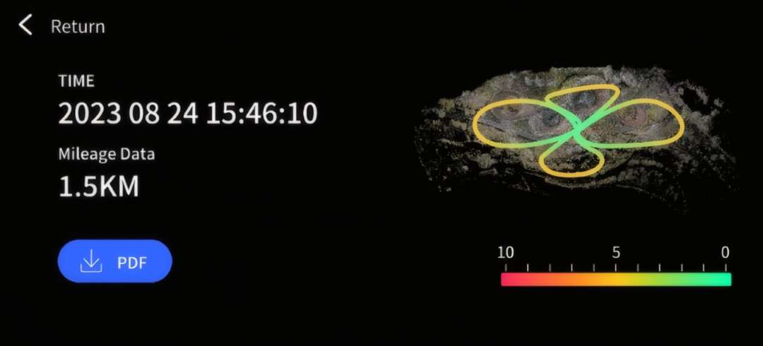
The accuracy verification report displays a map of the point cloud, scanning route loops, mileage and a colour quality scale — the operator evaluates the result before leaving the site.
Software and automation
The LixelStudio desktop application provides a full point cloud workflow: capture, editing and processing of data, compatibility with .las and .ply formats, and plugin support. The LixelGO mobile application allows controlling scanning directly from a smartphone, monitoring data collection progress in real time, and checking point cloud quality immediately after completing a pass. Data transfer takes place via USB 3.1 Gen2 or via Wi-Fi and Bluetooth.
Modularity and accessories
The package supports a 2 m extension pole, a hands-free backpack mounting system, a phone mount, as well as drone and vehicle mounts. This allows the scanner to be adapted to different survey routes — from a walking tour of the site to aerial surveying with a drone.
Safety and operating conditions
The IP54 protection class protects the electronics from dust and splashes during operation on a construction site or in field conditions. The operating temperature range is -20 °C – 50 °C, allowing the device to be used in winter and summer without an additional thermal cover. The manufacturer recommends not blocking the ventilation openings during operation: significant blockage reduces cooling efficiency and may lead to automatic shutdown of the device.
Areas of application
- Topographic surveying: LiDAR with a range of 0.5–120 m and absolute accuracy of 3 cm allows capturing the terrain of large areas in a single pass without placing additional targets.
- Engineering works: a point cloud with a 1 mm step conveys the geometry of structures for further calculations without a separate field processing stage.
- Technical inspection and maintenance: a cloud thickness of up to 5 mm within 10 m of the movement trajectory ensures clear contours of pipes, cable runs and metal structures during inspection.
- Construction: the accuracy verification report and one-click marking of control points speed up monitoring of completed work volumes right on the site.
- Agriculture and forestry: vehicle and drone mounts allow surveying large areas of fields or forest plots without walking to every point.
- Film and game production: a photorealistic-quality coloured point cloud based on the LixelUpSample™ algorithm serves as the basis for 3D models of locations without manual texturing.
Compatibility of the XGRIDS L2 Pro 32/120 Standard Package
- RTK modules: compatible with the standard and survey-grade RTK module for receiving satellite corrections.
- Carrying mounts: compatible with a backpack with a stabilising arm and a soft-padded backpack for carrying the device in field conditions.
- Extension pole: supports a 2 m extension pole for scanning from a distance or at height.
- Mounting points: compatible with a mobile phone mount, a drone mount and a vehicle mount.
- Transportation: supplied with a protective transport case for storing the device and accessories.
Package contents
- XGRIDS L2 Pro 32/120 scanning head
- Battery
- Standard RTK module
- Survey-grade RTK module
- Control point (GCP) collection board
- Mobile phone mount
- 2 m extension pole
- Backpack with stabilising arm
- Soft-padded backpack
- Protective transport case
- USB 3.1 data transfer cable
- User manual
Technical specifications of the XGRIDS L2 Pro 32/120 Standard Package
| General information | |
|---|---|
| Operating temperature | -20 °C – 50 °C |
| Protection class | IP54 |
| Voltage | 14.4 V |
| Capacity | 46.8 Wh |
| Point cloud formats | .las, .ply |
| Image formats | .jpg |
| System parameters | |
| Weight | 1.7 kg (without battery) |
| Dimensions | 180 × 130 × 400 mm |
| Housing material | industrial-grade aluminium |
| Power consumption | <30 W |
| Interfaces | USB 3.1 Gen2 |
| Storage | 1 TB SSD |
| Continuous operating time | 90 min. |
| Wireless modules |
|
| Accuracy | |
| Absolute vertical/horizontal accuracy (RMSE) | 3 cm |
| Real-time relative accuracy (RMSE) | 2 cm |
| Post-processed relative accuracy (RMSE) | 1 cm |
| Repeat pass accuracy (RMSE) | 2 cm |
| Point cloud thickness | 0.5 cm |
| LixelUpSample™ | supported |
| Features | |
| Visual positioning | supported |
| Real-time RGB | supported |
| Real-time RTK fusion | supported |
| LiDAR (XGRIDS L2 Pro 32/120) | |
| Number of LiDAR channels | 32 |
| Working range | 0.5–120 m |
| LiDAR sensor | Class 1 / 905 nm |
| Sensor field of view | 360° × 270° |
| Scanning frequency | 640000 points/s |
| Panoramic image camera | |
| Camera resolution | 2 × 48 MP |
| Panoramic image resolution | up to 56 MP |
| Focal length | 2 mm |
| Aperture | F/2.0 |
| CMOS sensor | 1/2" |
| Shutter | rolling shutter |
| Field of view | 190° × 190° |
| Visual positioning camera | |
| Resolution | 1 × 1 MP |
| Shutter | global shutter |
| Field of view | 190° × 119° |
| Accessories | |
| Backpack with stabilising arm | 60 × 60 × 15 cm, 2.5 kg |
| Soft-padded backpack | 55 × 35 × 25 cm, 2.7 kg |
| Transport case | 42 × 34 × 18 cm, 6.6 kg with the system |
| 2 m extension pole | supported |
| Mobile phone mount | supported |
| Control point board | supported |
What scanning accuracy does the L2 Pro provide?
The L2 Pro delivers absolute accuracy of 3 cm and relative accuracy of 2 cm in real time, without post-processing. This is achieved through the fusion of LiDAR, visual sensors and IMU with AI-powered Multi-SLAM algorithms. The point cloud thickness is only 5 mm, giving clear lines and contours even on complex objects. The proprietary LixelUpSample™ algorithm additionally densifies the point cloud to 1 million points/m² with a 1 mm step.
What tasks is this scanner suitable for?
The L2 Pro is designed for topographic surveying, construction, engineering investigations, facility inspection, forestry and agriculture, as well as film and game production. The LiDAR 32/120 scanning range reaches 0.5–120 m with a frequency of 640,000 points/s, allowing large objects to be covered quickly. Thanks to IP54 and an operating temperature range of −20…+50°C, the device works equally confidently indoors and on an open construction site.
Can you scan without a GPS signal?
Yes, the exclusive Multi-SLAM algorithm provides stable mapping under conditions of limited satellite signal — underground, in tunnels, subways or buildings. The device maintains continuous absolute coordinates even when RTK is lost at a distance of up to 100 m. This solves a typical problem of traditional surveying solutions, which lose accuracy without a stable GNSS signal.
What's included in the delivery package?
The Standard 32/120 package includes the device itself, a battery, an RTK module, a phone mount, a control point (GCP) collection board, a transport case, and a carrying backpack. Also available are a 2 m telescopic pole, drone/vehicle mounts, and a harness system for hands-free operation. The device is ready to work "out of the box" — the LixelStudio software (PC) and the LixelGO application (smartphone) cover the full cycle from data collection to export to .las/.ply.
How long does the device run without recharging?
One battery charge (14.4V, 46.8Wh) provides up to 90 minutes of continuous scanning, and a full charge takes about 2 hours. The built-in 1TB SSD allows storing large volumes of point clouds without the need for constant file transfer. Data transfer to a computer is carried out via USB 3.1 Gen2 within minutes after switching the device to USB mode.
Why buy the XGRIDS L2 Pro 32/120 Standard Package from EXPERT3D?
EXPERT3D has been supplying professional 3D equipment since 2012. We provide technical consultation and assistance in selecting the scanner configuration for a specific project. The XGRIDS L2 Pro 32/120 Standard Package comes with an official warranty and authorised service support. Delivery is available throughout Valencia and the EU. As an official representative of XGRIDS, we guarantee 100 % equipment authenticity, a fair price, authorised service and an official warranty.